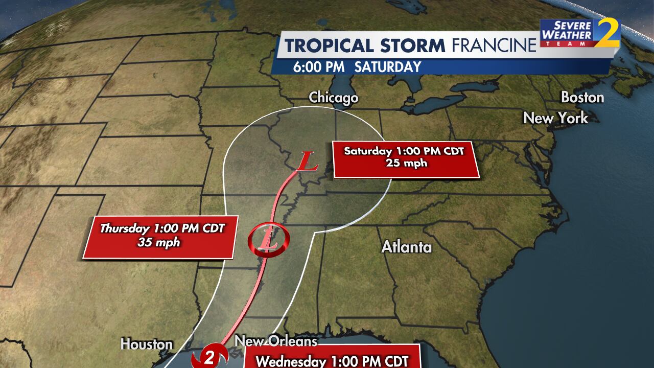
ATLANTA — Potential Tropical Cyclone 6 became Tropical Storm Francine on Monday and continues to strengthen early Monday evening in the southwest Gulf of Mexico.
Severe Weather Team 2 Meteorologist Brian Monahan says he expects Francine to strengthen quickly as it moves toward the Central Gulf Coast with a likely landfall late Wednesday.
[DOWNLOAD: Free Severe Weather Team 2 App for alerts wherever you go]
While the official NHC intensity has increased the landfall intensity to Category 2, there is a possibility Francine could be a major Category-3 hurricane at landfall. After landfall, the forecast track takes Francine across the Mississippi River valley
[INTERACTIVE: StormTracker 2HD Radar]
With a strengthening system that is just starting to get well organized, Monahan says there remains uncertainty in the forecast track.
Any shifts in the track east (or west) will impact how significant the impact is locally.
Things to know:
- Breezy weather ahead.
- Increasing rain into our area overnight Wednesday through Thursday and Friday.
- scattered showers and storms would likely linger into at least parts of the weekend as well.
- potential exists for 1-3″+ of rainfall area-wide.
[UPLOAD PHOTOS: Share your weather photos with us here]
©2024 Cox Media Group


