ATLANTA — Get ready for severe weather. It will be a rainy Easter but much more dangerous weather is ahead starting tonight.
Severe Weather Team 2 is tracking the timing and threats for your area as the system moves toward Georgia, all day on Channel 2 Action News.
Here’s what you need to know:
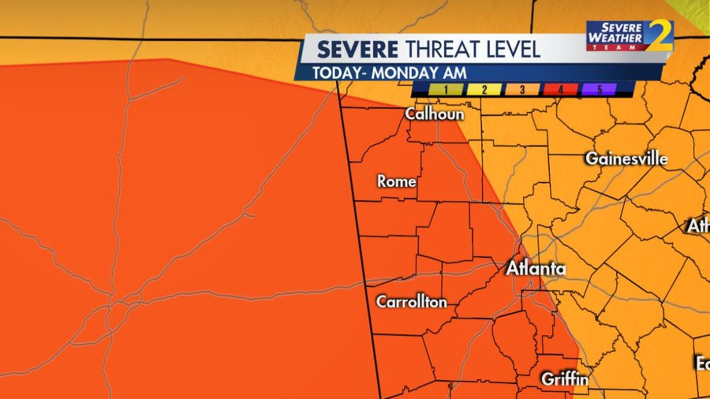
- Severe Weather Team 2 is tracking a severe weather outbreak Easter Sunday into Monday morning-- heavy rain, damaging wind, and long-tracked tornadoes are possible.
- There is a level 4 of 5 severe weather threat for much of Georgia, including part of Atlanta. Strong tornadoes are possible.
- There is a wind advisory before the storms with wind gusts of 35-40 mph, which could bring down trees.
- Wind and heavy rainfall are likely today. Heavy rain could produce some flash flooding.
- Strong storms will begin to develop around 8 p.m. Sunday.
- Overnight, the strongest storms will move through Georgia.
[Download the FREE Severe Weather Team 2 app for alerts as storms approach where you live]
LEVEL 4 of 5 risk has expanded to include the western half of our area.
— Brad Nitz (@BradNitzWSB) April 12, 2020
Please don't pay too much attention to which side of the line you're on. The weather knows nothing about the lines we draw. In this case the threat is significant and increasing for all of us. pic.twitter.com/cnAA6z71eo
The window for strong/severe storms will start to open around 2-3pm and stay open through just before sunrise Monday.
— Brian Monahan, WSB (@BMonahanWSB) April 12, 2020
This is a major severe weather threat to north Georgia. @wsbtv #StormWatchon2 https://t.co/fvhnh8AiVP

© 2020 Cox Media Group


