
Severe Weather Team 2 Meteorologist Ashley Kramlich says a few isolated storms are possible this afternoon but the main line of storms will be coming in later tonight.
The threat of severe weather moves in after midnight through 8 AM Monday morning.
[DOWNLOAD: Free WSB-TV Weather App for alerts wherever you go]
Along the leading edge of the line, 70 mph+ damaging winds, spin-up tornadoes and some isolated large hail are possible.
Kramlich says temperatures will drop dramatically behind the front, with temperatures in the 30s by Monday afternoon.
[INTERACTIVE: StormTracker 2HD Radar]
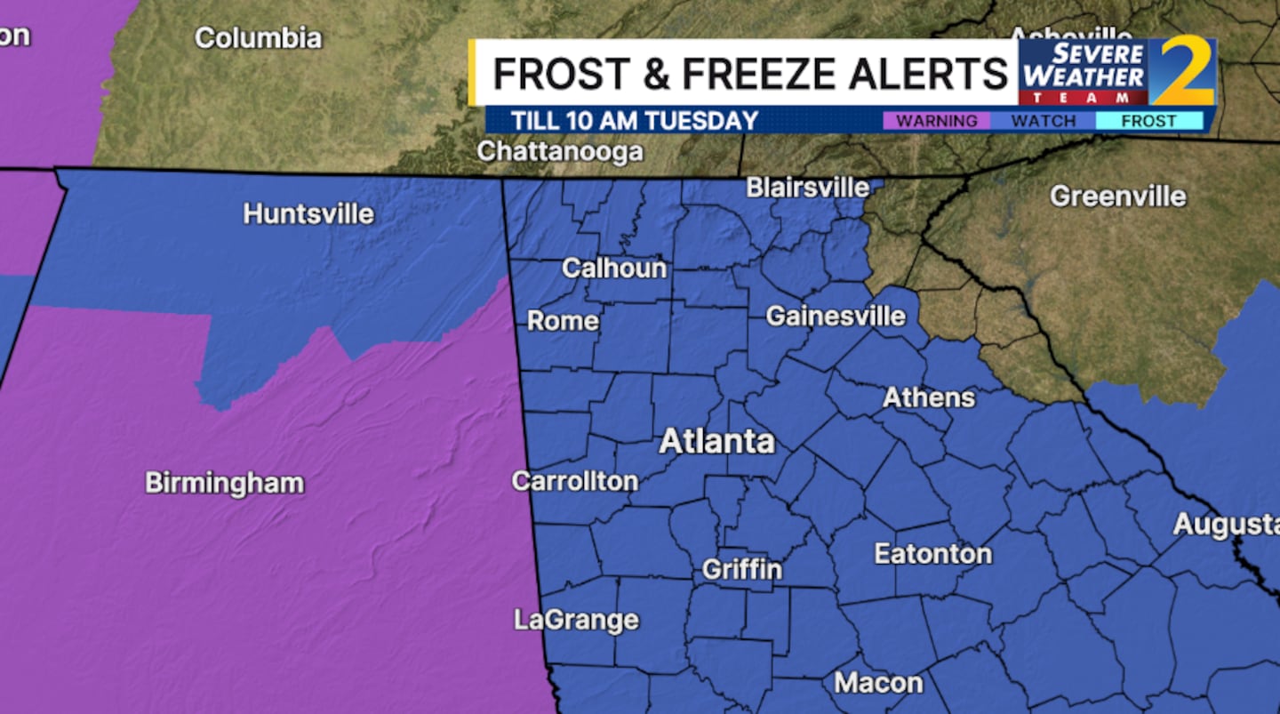
A freeze watch has been issued for Monday night into Tuesday with temperatures dropping into the 20s Tuesday morning.
[UPLOAD PHOTOS: Share your weather photos with us here]
©2026 Cox Media Group


