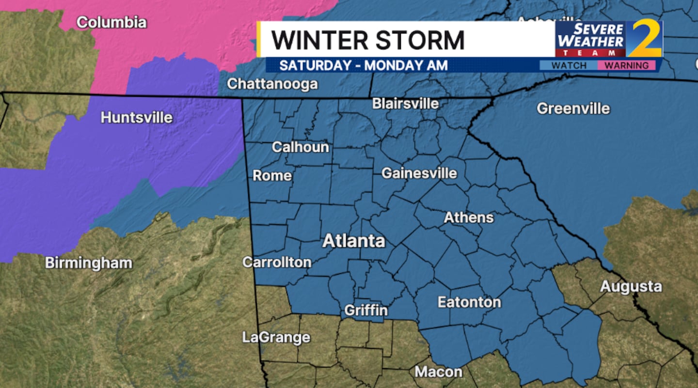
The winter storm watch has expanded for more of north Georgia and metro Atlanta ahead of a storm with the potential of significant impacts.
This is an evolving weather situation. Severe Weather Team 2 is going over the updating models and timing LIVE on Channel 2 Action News.
A winter storm watch will be in effect Saturday through Monday morning for the following counties:
- Baldwin, Banks, Barrow, Bartow, Butts, Carroll, Catoosa, Chattooga, Cherokee, Clarke, Clayton, Cobb, Coweta, Dade, Dawson, DeKalb, Douglas, Fannin, Fayette, Floyd, Forsyth, Fulton
- Gilmer, Glascock, Gordon, Greene, Gwinnett, Hall, Hancock, Haralson, Henry, Jackson, Jasper, Jefferson, Jones, Lumpkin, Madison, Morgan, Murray, Newton, Oconee, Oglethorpe
- Paulding, Pickens, Polk, Putnam, Rockdale, Spalding, Taliaferro, Towns, Union, Walker, Walton, Warren, Washington, White, Whitfield and Wilkes
It also includes Clay County, North Carolina in the Channel 2 Action News viewing area.
[DOWNLOAD: Free WSB-TV Weather App for alerts wherever you go]
The highest confidence of winter weather impacts is primarily coming from freezing rain and ice.
Accumulation on trees and power lines will likely causing widespread power outages from the north Georgia mountains to the northern metro Atlanta area.
A transition over to a cold rain is possible Sunday evening across metro Atlanta.
A cold rain/freezing rain mix is possible, but impacts should be much lower south of the metro, including LaGrange, Griffin and Thomaston, as warmer air moves in.
There will be a bit of transition likely with some period of rain as we head into Sunday around parts of metro Atlanta and southward. The greatest threat for dangerous travel and power outages will occur for Northeast Georgia.
[INTERACTIVE: StormTracker 2HD Radar]
[UPLOAD PHOTOS: Share your weather photos with us here]
©2026 Cox Media Group


