ATLANTA — There is risk of severe weather in north Georgia, including metro Atlanta, as storms move through.
6:12 p.m. - A Severe Thunderstorm Warning was issued for Meriwether and Troup County until 7:15 p.m.
5:46 p.m.. - Hail is being detected by Stormtracker 2 3D in the severe storm in Troup County. Damaging winds are also possible.
5:40 p.m. - A Severe Thunderstorm Warning was issued for Meriwether and Troup County until 6:15 p.m.
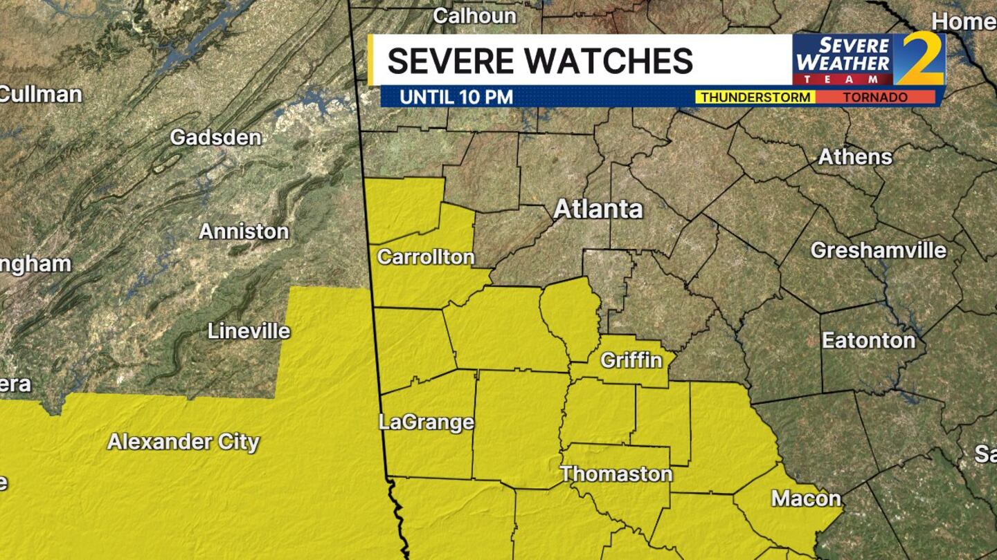
5:29 p.m. - A Severe Thunderstorm Watch is in effect until 10 p.m. for parts of metro Atlanta, plus west and middle Georgia. Damaging wind gusts are the main threat.
4:58 p.m. - A severe thunderstorm warning has been issued for parts of Heard, Troup and Harris counties in West Georgia until 5:45 pm. Damaging wind gusts are possible.
We will have scattered showers and a few thunderstorms, with heavy rain where storms manage to develop, as a cold front moves through this evening.
There is potential for strong wind gusts and even some hail, but it comes and goes pretty quickly.
Severe Weather Team 2 tracks it LIVE on Channel 2 Action News.
As we head into Tuesday morning, we will have clouds but a generally dry start to the day.
A few isolated showers and storms develop in the afternoon, and those will be around through Tuesday evening.
The total rainfall from Monday and Tuesday won’t be that heavy, with less than a half-inch in most areas.
We will get drier later this week, with sunshine and lower humidity beginning Wednesday.
[DOWNLOAD: Free WSB-TV News app for alerts as news breaks]
[SIGN UP: WSB-TV Daily Headlines Newsletter]
©2026 Cox Media Group


