ATLANTA — The severe storm risk has diminished Monday after an evening of rain and strong to severe storms in north Georgia, according to Severe Weather Team 2 Meteorologist Eboni Deon.
On WSB Tonight at 11 on Sunday, Severe Weather Team 2 Meteorologist Ashley Kramlich said much of metro Atlanta was under a Level 2 out of 5 risk for severe weather, but the western parts of the metro and northwest Georgia were under a Level 3 of 5 risk.
Last night, you could expect to see possible strong, damaging wind gusts and hail.
[DOWNLOAD: Free Severe Weather Team 2 App for alerts wherever you go]
Live Updates
9:45 p.m.
Severe Thunderstorm Warning in Lumpkin, Dawson and Union counties expires.
9:30 p.m.
Severe Thunderstorm Warning in Banks County expires.
8:52 p.m.
Severe Thunderstorm Warning in effect for parts of Lumpkin, Dawson and Union counties until 9:45 p.m.
8:42 p.m.
Severe Thunderstorm Warning in Banks County extended until 9:30 p.m.
8:32 p.m.
Severe Thunderstorm Warning issued in Banks County until 8:45 p.m.
8:00 p.m.
Severe Thunderstorm Warning expires in Barrow and Gwinnett counties.
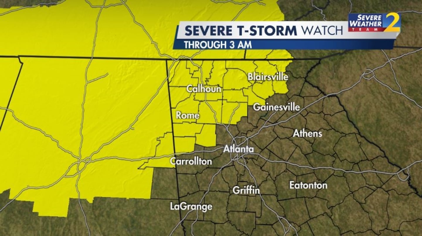
7:52 p.m.
Severe Thunderstorm Watch in effect for much of western metro Atlanta and north Georgia until 3 a.m., including Haralson, Paulding, Polk, Floyd, Bartow, Cherokee, Chattooga, Gordon, Pickens, Dawson, Lumpkin, White, Towns, Union, Fannin, Gilmer, Dade, Catoosa, Whitfield, Walker and Murray counties.
7:35 p.m.
Severe Thunderstorm Warning issued for Barrow and Gwinnett counties until 8 p.m.
Severe Weather Team 2 will have the latest on storm tracks and impacts on WSB Tonight at 11 p.m.
[INTERACTIVE: StormTracker 2HD Radar]
[UPLOAD PHOTOS: Share your weather photos with us here]
PREVIOUS FORECAST:

©2022 Cox Media Group