ATLANTA — Hurricane Isaias made landfall near Destin, Florida as a Category 2 storm Friday night.
The 2 a.m. advisory from the National Hurricane Center says Isaias is now a “post-tropical cyclone,” meaning it’s no longer getting is energy from the water. The storm is moving north at 20 mph with maximum sustained winds of 65 mph.
LIVE Severe Weather Team 2 coverage of Hurricane Isaias, on Channel 2 Action News Saturday AM
[DOWNLOAD: Free WSB-TV Weather App for alerts wherever you go]
WHAT ARE THE ISAIAS IMPACTS FOR GEORGIA NOW?
Severe Weather Team 2 Meteorologist Ashley Kramlich says while the storm will weaken in terms of wind speeds, that does not mean the impacts for us in Georgia will weaken.
Widespread and potentially heavy rain will last through Saturday morning before it starts to break up late morning into the afternoon. More outer rain bands will form during the afternoon into the evening, bringing the potential for spin-up tornadoes into tonight.
“The greatest threat though is going to be for very heavy rainfall and gusty winds,” Kramlich says.
HIGH WIND WARNING IN EFFECT
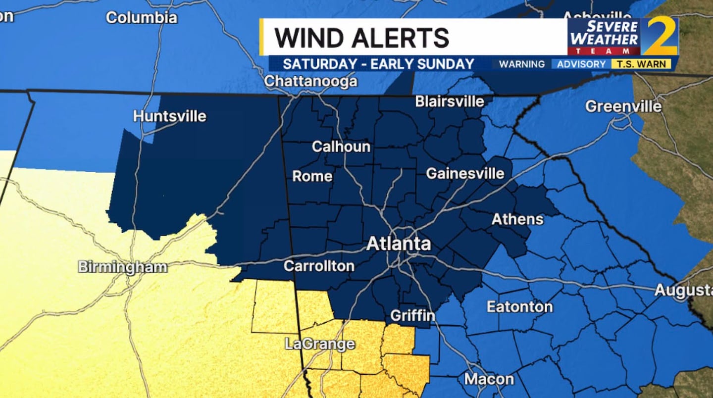
Wind will be increasing throughout the day. A High Wind Warning is in effect where wind gusts will potentially exceed 50 mph. In the wind advisory, gusts to 40 mph are possible. Gusts in this range will bring down trees and power lines, especially with increasingly saturated ground.
A Tropical Storm Warning is in effect until 7:30 a.m. Saturday for the following counties in the Channel 2 Action News viewing area: Heard, Meriwether, Pike, Troup and Upson and Randolph County, Alabama. This is where there could be a brief period of sustained wind up to tropical storm force, along with gusts in excess of 50 mph.
[UPLOAD PHOTOS: Share your weather photos with us here]
©2026 Cox Media Group


